The Sierra Foothill Research & Extension Center has unique flora, fauna, and land characteristics. The following pages offer detailed information about the local climate, plants, wildlife, and soils found on this 5,700 acre foothill landscape.
Plants at SFREC
Unmodified foothill woodland-grassland -- The major trees are blue oak and interior live oak, ranging from 40 to 200+ trees per acre. There are some foothill pine and, at higher elevations, black oak and ponderosa pine. Common shrubs include buckbrush, toyon and poison oak. Major forbs include filaree, annual clovers and geranium. Common annual grass species are soft chess, ripgut brome, red brome, annual fescue, wild oats, and medusahead. Perennial grasses include purple stipa. Cleared areas -- Most trees and shrubs have been removed; most resident grasses and forbs remain. Trees have been reduced to 4 to 50 per acre. In one area they have been removed completely. Some areas have been seeded to improved species, including subterranean clover, rose clover, Hardinggrass and ryegrass.
View a list of Plants at SFREC (PDF, 30.77KB)
Animals at SFREC
Oak woodlands in California provide one of the richest habitats in the state for wildlife. It is estimated that approximately half of California's 660 terrestrial vertebrate species utilize oak woodlands at some time during the year. Some of the common mammals at the Center are squirrels, deer, racoons, skunks, foxes, bobcats, coyotes and occasionally, mountain lions. Reptiles include fence lizards, skinks, whiptails, alligator lizards, garter snakes, rattlesnakes, gopher snakes and kingsnakes. Several years ago, a research project conducted a thorough inventory of bird species found at the Center, which is listed below.
View a List of Birds located at SFREC (PDF, 104KB)
Soils & Geology
Five soil series dominate. Four, usually intermingled, are developed from basic metavolcanic rocks: Auburn, the most extensive, is loam in texture, 1-2 feet deep, well drained and slightly acid; Sobrante, similar to Auburn but 1.5-3 feet deep with slightly more clay in the subsoil; Las Posas and Argonaut, 1.5-3.5 feet deep with clayey subsoils. The fifth series is Wyman, 4-5 feet deep, loam with clay-loam subsoil, formed in alluvium from the four series previously described.
- Map and Legend of SFREC Soils (PDF, 1.2 MB)
- UC Davis Soil Resource Laboratory
- SoilWeb: An Online Soil Survey Browser
Range Forage Production
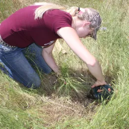
SFREC has over 40 years of rangeland forage production and environmental data. This information is widely used for assessing how current-year forage production compares to previous years and for forecasting potential trajectories of peak forage production for the current growing season.
View the Site Weather Station Data and web application for Forage Production & Historical Weather Data. This link is for Historical Forage Data 1979-2024 (PDF, 75.14).
Climate Change Data
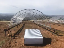
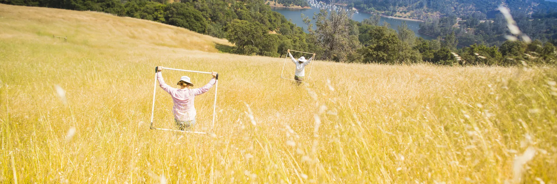
Between 2012 and 2014 the California Floristic Province, a priority hotspot for global biodiversity conservation, has experienced the hottest and driest period on record. Evidence is rapidly mounting indicating that these co-occurring periods of precipitation deficit and warm temperatures are human caused, likely to increase over the next century, and drive major changes in drought duration and intensity. We have submitted to NSF Field Station and Marine Lab Facilities program a proposal to build shared infrastructure that supports development of an integrated understanding of how drought and warming will impact biodiversity and function
of Mediterranean ecosystems. This includes (1) a distributed wireless sensor network that provides continuous measurements of topoclimatic variation in soil moisture deficit and temperature profiles across the 2,428 ha University of California Sierra Foothill Research and Extension Center (SFREC), and (2) distributed infrastructure that allows automated, economical and large-scale manipulation of precipitation deficit and warming in the field. The wireless network provides critical long-term data on topoclimatic exposure to drought and warming and a simple means for researchers to add project-specific sensors across the landscape. The infrastructure allowing simultaneous manipulation of drought and warming in the field provides unmatched capacity to mechanistically evaluate factors (e.g. ecophysiological traits, genetic diversity) and interactions (e.g. competition, biological invasions) that drive variation in plant population, species and community sensitivity to drought and warming. While climate change impacts on biological systems are expected to be severe, these impacts are not expected to be evenly distributed among populations, species, or communities. Instead, impacts of regional climate change on biodiversity will be mediated by local exposure to climate change, species-specific sensitivity to climate change, and how adaptive capacity and biotic interactions alter species sensitivity to rapidly changing environmental conditions. While the need for an integrated understanding of how these factors drive climate change impacts on biodiversity is extensively recognized, across the globe we have minimal field infrastructure that allows us to simultaneously assess impacts due to climate change exposure and impacts due to climate change sensitivity. The infrastructure proposed here represents a major step toward filling this gap, allowing researchers to test hypotheses related to processes and mechanisms driving biodiversity response to a warmer and drier future and providing unparalleled ability to test and model conservation benefits of various biodiversity management tools and strategies. Ultimately this integrated infrastructure should support major positive steps for biodiversity conservation in these and similar mediterranean systems across the globe.