UC ANR is committed to providing an accessible and inclusive web experience for all users. If you encounter an accessibility barrier or need content in an alternative or remediated accessible format, please contact anraccessibility@ucanr.edu.
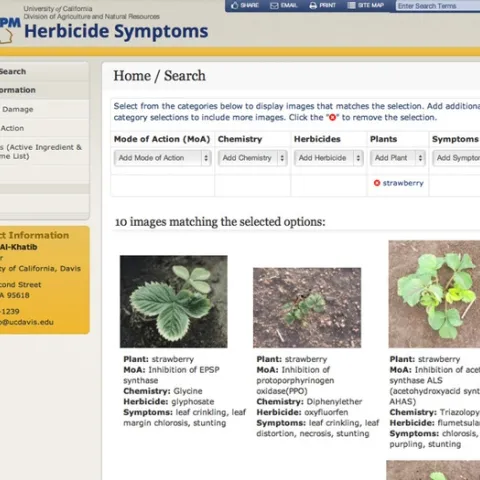
Identifying nontarget crop and ornamental plant damage from herbicides has become much easier with the launch of a new online photo repository by the Statewide IPM Program, University of California Division of Agriculture and Natural Resources.
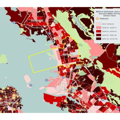
Today I went to a great D-Lab Workshop on Demographic Mapping Tools. Berkeley's GIS and Map Librarian, Susan Powell walked us through the use of several very easy to use mapping tools available through UC Berkeley. Both are really great for quickly visualizing data from many different sources.
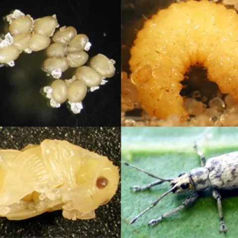
If you like to see lady beetles devouring aphids or assassin bugs piercing spotted cucumber beetles, then you'll love the workshop taking place Saturday, April 11 in rural Zamora, Yolo County. That's not to say you'll see beneficial insects doing their thingbut you might.
This is a course that was developed for vineyards but it works for any crop. http://www.vineyardteam.org/resources/onlinecontinuingeducation.php Online Courses are now available for obtaining continuing education (CE) credits approved by the Department of Pesticide Regulations (DPR).
Just so we don't forget, but there are a lot more threats to California than ACP and PSHB. There's a lot more where they came from. Here's one that has landed in Florida that could easily with the shipment of infested plants arrive in California.
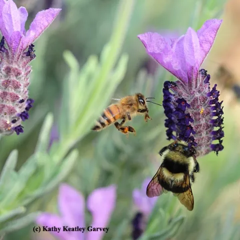
Hear the buzz, feel the buzz, capture the buzz! With your camera! If you're into pollinators, plants and photography, and want to share your work nationally, here's a new project for you.
Our CASI Center's John Diener, a Five Points, CA farmer and long-term workgroup member, along with Jeff Mitchell of UC Davis, will be participating as panelists on Monday, April 13th, from 2 6 PM in the Tampalpais Room of the David Brower Center at 2150 Allston Way at Oxford Street in Berkeley, CA...
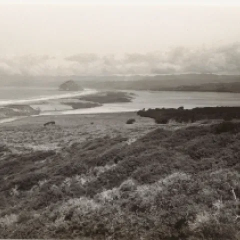
Plus sa change, plus sa la meme chose. Thanks to Heather Constable, who went out exploring near Morro Bay. Here is one of her retakes. Date of original photo: Feb 25, 1936, taken in San Luis Obispo County, California, US. Looking north toward Morro Bay.
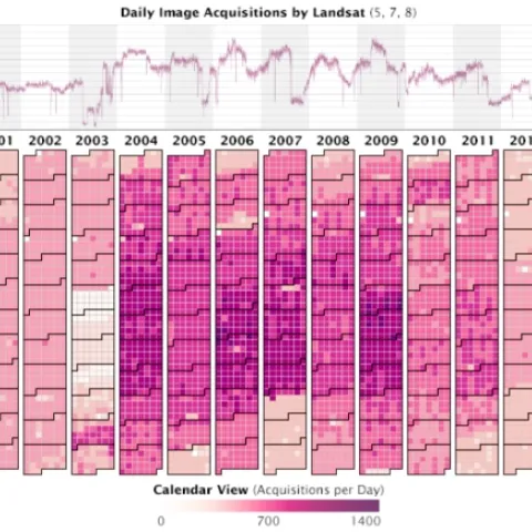
Very nice overview of how the Landsat archive has jump started new avenues in earth science, ecoinformatics, and public communication and participation. In 2008, the U.S. Geological Survey took 3.6 million images acquired by Landsat satellites and made them free and openly available on the Internet.