Workshop: Friday February 13. 1:00 - 2:30 pm PT

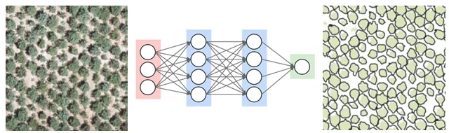
Drone images have allowed researchers to explore new questions due to their incredible spatial resolution. Ironically however, the level of detail renders traditional image analysis methods largely ineffective.
This webinar will describe how Deep Learning methods can be used for object detection and segmentation in high resolution imagery. A workflow for doing Deep Learning in ArcGIS Pro will be explained, with a comparison of the results of two commonly used Deep Learning algorithms (MASK R-CNN and SAM) applied to drone imagery of orchard trees taken at different times of the year.
Presenters
- Maggi Kelly, Director, IGIS
- Shane Feirer. GIS Lead, IGIS
Recording
This work is the result of a collaborative effort between UC ANR IGIS Statewide Program, the USDA-NIFA/NSF AI Institute for Next Generation Food Systems (AIFS), and UC Love Data Week.